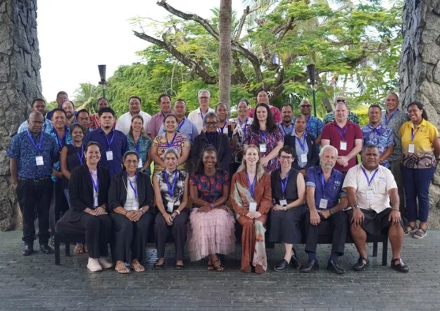
Digital Earth Pacific, run by the Pacific Community (SPC), turns open satellite data into AI-processed disaster-risk, coastline and mangrove products for 20 Pacific governments; by 2025 it had deployed or scaled nine regional products and trained over 220 people.
20
Pacific countries and territories participating
9
Regional data products deployed or scaled
220+
People reached through training
2016-2022
Mangrove dataset coverage period
Details
Maturity
Scaling
Promoter
Pacific Community (SPC) — Geoscience, Energy and Maritime Division
The Pacific Community (SPC) built Digital Earth Pacific on Microsoft's Planetary Computer, using AI and cloud processing to turn petabytes of openly available satellite imagery into products usable for national planning. Early applications included assessing volcanic-eruption damage to crops and water supplies, and helping identify relocation sites for communities displaced by cyclones.
Activities
By its 6th Steering Committee meeting, held in Nadi, the programme brought together representatives of 20 Pacific countries and territories — including Fiji, Papua New Guinea, Samoa, Solomon Islands, Tonga, Vanuatu, Kiribati and Tuvalu — with partnerships spanning Geoscience Australia, the Group on Earth Observations, Digital Earth Africa, and two regional geospatial councils (PGRSC and PGSC). Products cover coastline change, flood patterns, mangroves, seagrass, vegetation height and near-shore water depth.
Results
The programme reported nine regional data products deployed or scaled and more than 220 people reached through training. One concrete product, the Digital Earth Pacific Mangroves Extent and Density dataset, tracks mangrove change across Pacific Island Countries and Territories from 2016 to 2022 with planned annual updates, is openly licensed under Creative Commons Attribution 4.0, and is hosted publicly on AWS.
Conclusions
Public reporting to date documents outputs and training reach rather than independently verified outcomes — the 2026 steering committee explicitly flagged 'strengthened national uptake' and 'clearer governance pathways' as unresolved priorities, so real-world decision impact is not yet independently measured.
Implementation
Indicative cost
Medium (€50k–€500k) — Built on Microsoft's Planetary Computer using openly available satellite imagery; specific programme cost figures not published in available sources.
Time to results
Long (> 3 years) — Running since 2022, ongoing; regional products reported deployed/scaled through the 6th Steering Committee meeting (2025-2026).
Staffing & skills
Pacific Community (SPC) — Geoscience, Energy and Maritime Division, Government representatives from 20 Pacific countries and territories, Partners: Geoscience Australia, Group on Earth Observations, Digital Earth Africa, PGRSC, PGSC
Conditions for success
Multi-country steering committee coordination
Reuse of Digital Earth Africa's open architecture
Open licensing (CC BY 4.0) and public hosting (AWS) of data products
National uptake and clearer governance pathways (identified as still needed)
Common failure modes
No independent study yet measures whether the data has changed an actual disaster response, coastal permit or land-use decision
Steering committee itself flagged that national uptake and governance pathways remain unresolved
Replication kit
Reusable artefacts from this practice — as published by their sources.
Tuvalu's Department of Lands and Survey built a machine-learning-assisted digital twin of Funafuti under the Pacific Community's Digital Earth Pacific …