Guyana's MRVS: Satellite-Verified Forest Payments, Then a Contested Carbon-Credit Sequel
Guyana
Guyana's Forestry Commission built a national satellite MRV system that verified a 0.068% deforestation rate, earning $190M from Norway (2009-2015). …
Cameroon · Yaoundé · See the Cameroon profile · See the Yaoundé profile
Evidence: Quasi-experimental Top 76% 33/100 · Ask Evidence Copilot about this practice
Free, open-access GLAD satellite alerts (8-day tree-cover-loss detection) let Cameroonian officials and civil society flag illegal logging in near-real time; a peer-reviewed econometric study found subscribers cut deforestation 18% versus non-monitored areas.
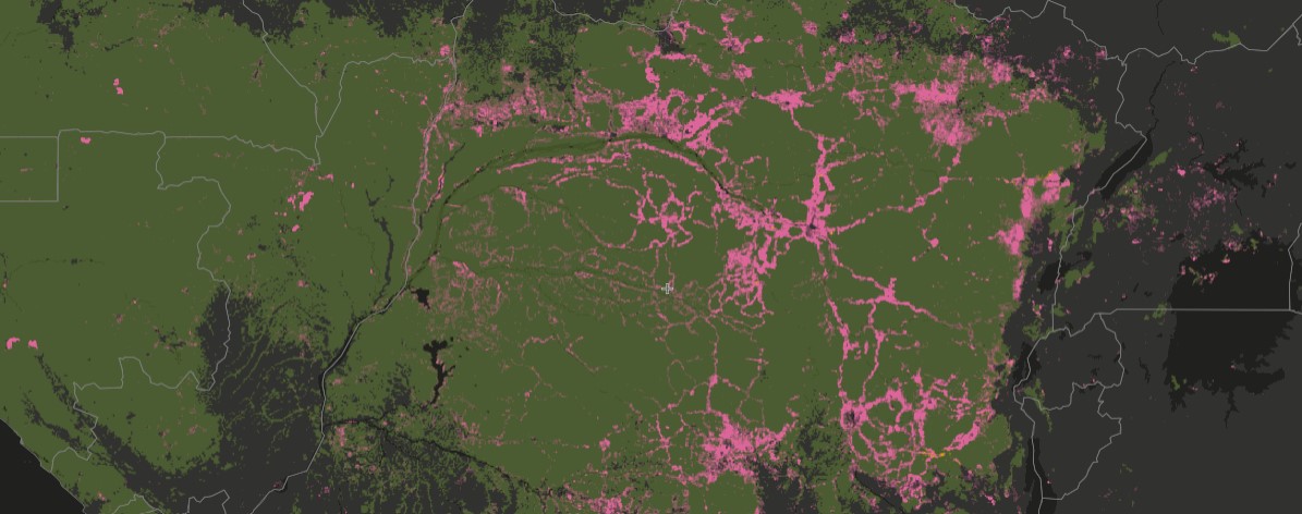
Global Forest Watch's GLAD alert system, developed by the University of Maryland and hosted by the World Resources Institute, publishes free satellite-derived tree-cover-loss alerts roughly every eight days across the tropics. In Cameroon, government forestry officials use the alerts to flag unauthorised logging inside forest titles and concessions, while civil-society monitors independently report suspected illegal clearing.
A peer-reviewed econometric evaluation found deforestation fell by roughly 18% relative to the 2011-2016 baseline in areas where the effect was statistically significant -- Central Africa, including Cameroon -- equivalent to an estimated 50,000 hectares of avoided deforestation per year across the monitored regions. The authors note their design was built to find the minimum plausible effect, so the true impact may be larger; effectiveness was strongest inside protected areas and logging concessions with existing enforcement follow-up capacity.
The practice is a governance and enforcement tool rather than a direct restoration or payment scheme: it strengthens the enforcement backbone that PES and REDD+ programmes elsewhere depend on. Results in South America and Asia were not statistically significant, likely reflecting competing monitoring tools or lower uptake.
National / regional programmes LIFE Programme
Indicative funding routes for practices of this type — always check each programme's current calls and eligibility rules.
Do you run this practice? Claim it — verified implementers get a public contact pathway and can propose corrections.
Where this practice's information was retrieved from, and when.
Guyana
Guyana's Forestry Commission built a national satellite MRV system that verified a 0.068% deforestation rate, earning $190M from Norway (2009-2015). …
Vietnam
Since 2010, Vietnam's nationwide Payment for Forest Environmental Services has raised ~VND 10,000bn (2008-2018), mostly from hydropower. Lam Dong piloted …
Brazil
Brazil's INPE space agency built DETER, a near-daily satellite deforestation-alert system, to target Amazon law enforcement; a peer-reviewed causal evaluation …
Colombia
Since 2012 Colombia's IDEAM has run SMByC, a satellite-based forest and carbon monitoring system using Landsat, Sentinel-2 and other imagery …
Open full copilot Grounded in cited practices — always check the sources.