Centro de Operações e Resiliência (COR) — Rio de Janeiro's Integrated City Command Centre
Brazil
Built in 8 months after a deadly 2010 landslide, Rio's Centro de Operações e Resiliência (COR) fuses 50+ agencies' data …
Sierra Leone · Freetown · See the Sierra Leone profile · See the Freetown profile
Evidence: Observational / pre–post Top 17% 81/100 · Ask Evidence Copilot about this practice
Freetown mapped 4,038 km of formal and informal bus routes (2018–19), then in 2024 trained residents of informal settlements as a community drone-mapping crew producing 5cm-resolution imagery that now feeds municipal planning.
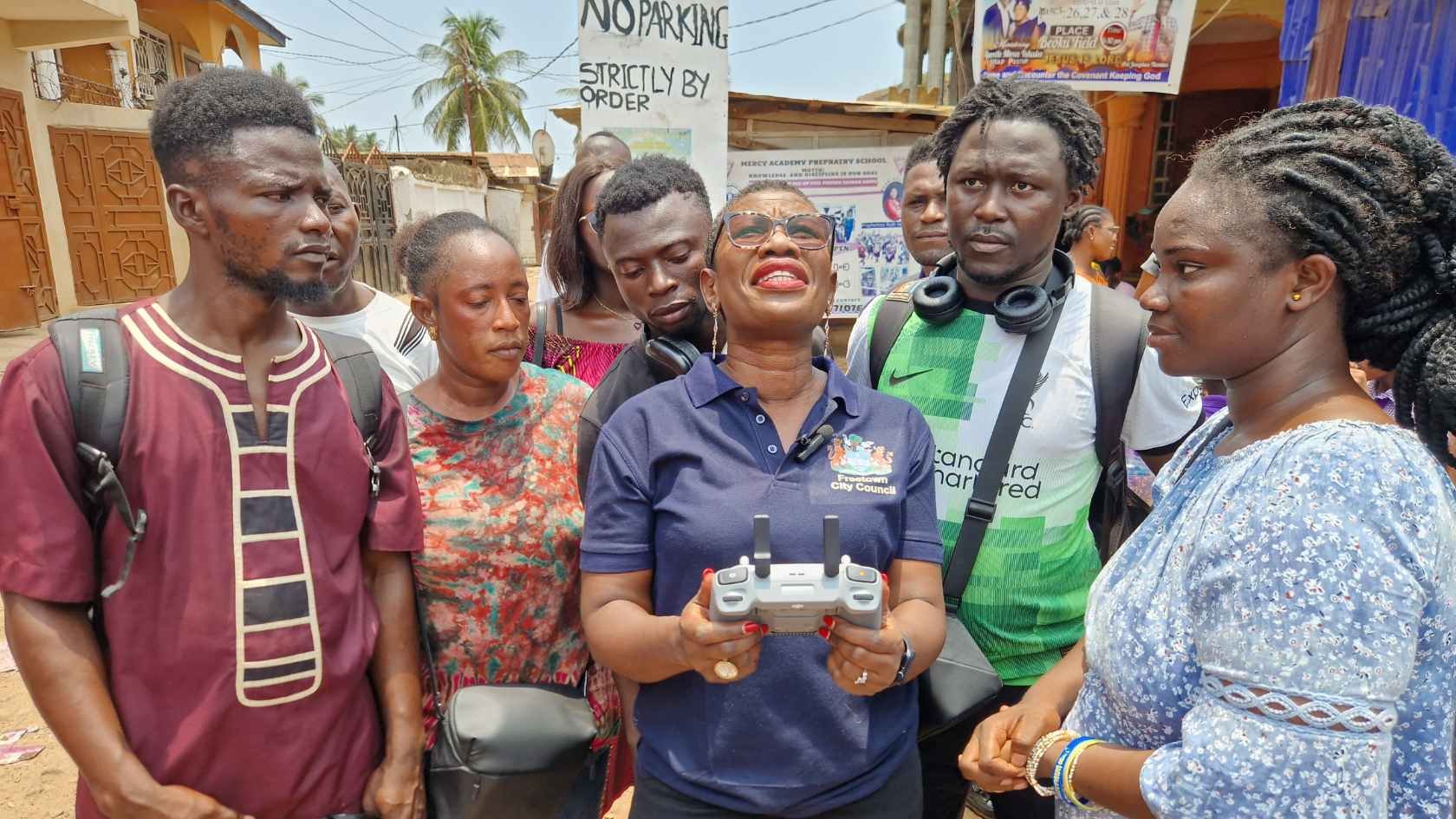
Freetown, which generates roughly 30% of Sierra Leone's GDP on under 0.5% of its land and houses about 15% of the national population, runs a multi-phase civic-data programme feeding into Mayor Yvonne Aki-Sawyerr's 'Transform Freetown' plan (launched January 2019 across eleven priority sectors), led by Freetown City Council with the Humanitarian OpenStreetMap Team, Fourah Bay College and the World Bank/GFDRR.
Phase one (2018–2019), led by Fourah Bay College engineering students with Where Is My Transport and World Bank/GFDRR support, combined mobile-phone call-detail-record mobility data, road-condition surveys and poverty data to map Greater Freetown's bus network. In early 2024, Freetown City Council launched a community drone-mapping programme with the Humanitarian OpenStreetMap Team, CODOHSAPA/FEDURP and Slum Dwellers International, funded by Germany's BMZ, training residents (including pilots recruited from informal communities) to produce high-resolution aerial imagery.
Phase one produced the first map of Greater Freetown's 4,038 km of formal and informal bus network, revealing seasonal travel differences and confirming Tower Hill as the city's primary employment destination. The drone programme trained 30 residents, growing to a 28-member crew including 10 pilots from informal communities, producing 5cm-resolution imagery and elevation models at a reported 3–10x lower cost than traditional aerial survey. Outputs now feed municipal tasks including waste management, property taxation, ward-boundary review and informal-settlement recognition.
National / regional programmes Philanthropic / foundation funding
Indicative funding routes for practices of this type — always check each programme's current calls and eligibility rules.
Do you run this practice? Claim it — verified implementers get a public contact pathway and can propose corrections.
Where this practice's information was retrieved from, and when.
Brazil
Built in 8 months after a deadly 2010 landslide, Rio's Centro de Operações e Resiliência (COR) fuses 50+ agencies' data …
Ecuador
Quito's planning authority and an Austrian/Ecuadorian/CIAT research team used the GeoCitizen participatory-GIS platform to run a 2013 land-zoning process on …
Peru
Since 2010, Lima Cómo Vamos has surveyed ~2,000 residents of Metropolitan Lima annually on urban quality of life. A 2022 …
Tanzania
Dar es Salaam's Ramani Huria trained 450 community members and students to map flood-prone informal settlements with OpenStreetMap and drones. …
Open full copilot Grounded in cited practices — always check the sources.