Sierra Leone's GIS-Supported Teacher Deployment Algorithm
Sierra Leone
Sierra Leone's Teaching Service Commission, with EdTech Hub and Fab Inc., built a Nobel-inspired matching algorithm pairing teachers' preferences with …
Kenya · Nairobi · See the Kenya profile · See the Nairobi profile
Evidence: Descriptive / self-reported Top 40% 53/100 · Ask Evidence Copilot about this practice
UNICEF and ITU's Giga initiative trained CNN classifiers on satellite imagery to find schools missing from national databases, adding 23,100 unmapped schools across 8 countries including Kenya and Rwanda — accuracy fell to ~57% in the poorest, most remote areas.
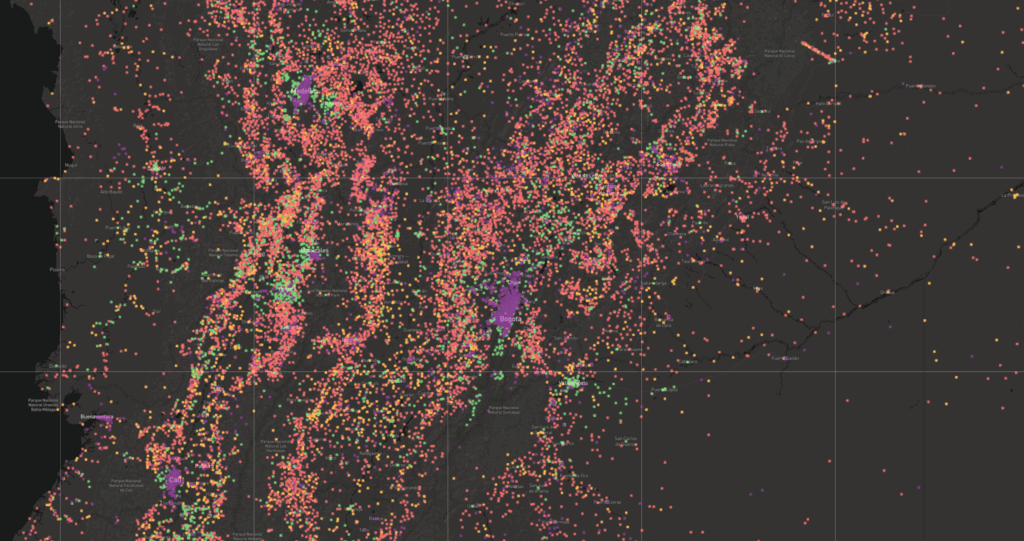
Most low- and middle-income countries do not have a complete, accurate record of where their schools physically are. UNICEF's Office of Innovation and the International Telecommunication Union (ITU) built the Giga initiative's school-mapping tool to close that gap.
Convolutional neural network classifiers (based on Xception and MobileNetV2 architectures), developed with technical partner Development Seed, were designed to scan high-resolution satellite imagery and detect school buildings missing from national education management information systems, as a first step toward planning electricity and internet connectivity for schools governments did not know they had.
Between 2020 and 2021, the system scanned 71 million map tiles at 60cm resolution across Kenya, Rwanda, Sierra Leone, Ghana, Niger, Kazakhstan, Uzbekistan and Honduras, processing 18 million supertiles in 25 hours at up to 2,000 supertiles per second.
The system added 23,100 previously unmapped schools to national registries. Country-specific model variants reached F1 scores of 0.94 in Rwanda, 0.90 in Kenya and 0.91 in Sierra Leone, with a global model at 0.85 and an overall AUC of 0.94. The Giga team's own code is open-sourced, and an independent review by IRCAI (a UNESCO-affiliated international research centre on AI) confirmed the technical results.
IRCAI's review also reported a significant equity limitation: model accuracy falls to roughly 57% in areas characterised by poverty and remoteness, meaning the tool is least reliable exactly where unmapped, unconnected schools are most likely to be found. No independent evaluation has yet shown that the newly mapped schools translated into actual connectivity investment or budget reallocation.
Do you run this practice? Claim it — verified implementers get a public contact pathway and can propose corrections.
Where this practice's information was retrieved from, and when.
Sierra Leone
Sierra Leone's Teaching Service Commission, with EdTech Hub and Fab Inc., built a Nobel-inspired matching algorithm pairing teachers' preferences with …
Fiji
A peer-reviewed Fiji Ministry of Education study combined child-functioning survey data with learning-support-needs data in a rule-based algorithm that more …
Malaysia
Malaysia's Ministry of Education (KPM) and UNICEF deploy SiPKPM, an AI early-warning system tracking 5 million learners on 7 risk …
Peru
A pre-registered World Bank RCT of an Anthropic Claude-powered AI career coach and math tutor across up to 110 Lima …
Open full copilot Grounded in cited practices — always check the sources.