Tallinn Smart City — Europe's first capital with free public transit for residents and fully digital city services
Estonia
Tallinn introduced free public transit for all registered residents in 2013 — Europe's first capital to do so — integrated …
Kenya · Nairobi · See the Kenya profile · See the Nairobi profile
Evidence: Observational / pre–post Top 17% 81/100 · Ask Evidence Copilot about this practice
A university-NGO consortium GPS-mapped Nairobi's ~130 informal matatu routes and 3,000+ stops, producing the first standardised (GTFS) map of an informal transit system serving 3.5 million daily riders — later adopted into Google Maps and cited in peer-reviewed research.
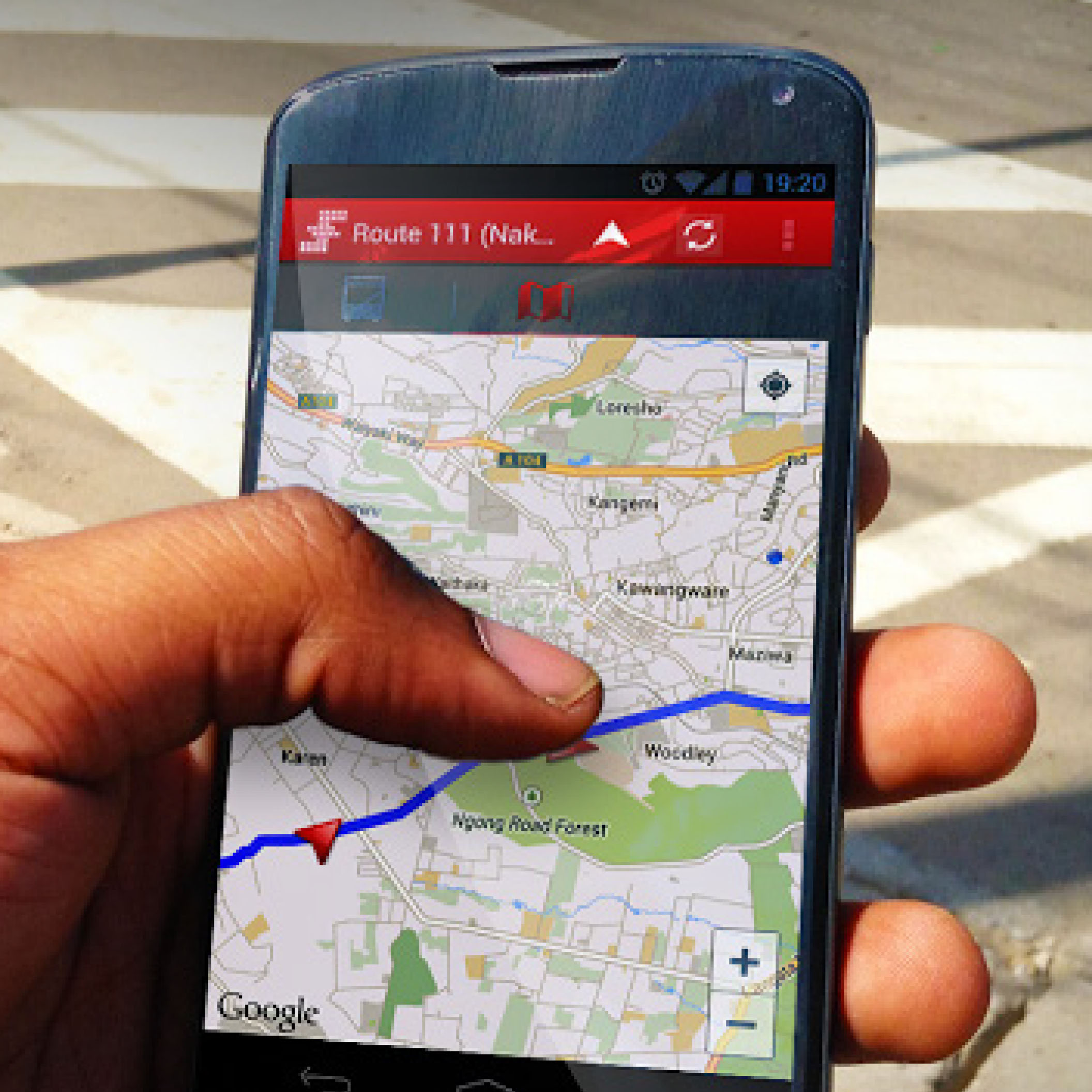
Nairobi's privately-run matatu minibuses carry an estimated 3.5 million passengers a day, but before 2013 the network had no official route map — only driver and association knowledge governed a system with no public data at all.
In February 2013 a consortium of MIT's Civic Data Design Lab, Columbia University, the University of Nairobi and design studio Groupshot, funded by The Rockefeller Foundation, sent University of Nairobi student fieldworkers out with GPS-enabled phones to ride and log the matatu network directly. The team charted more than 3,000 stops across over 130 routes and converted the data into an extended version of GTFS, the first time the standard had been adapted for an informal transit system anywhere. A geographically accurate map was released in January 2014.
The map logged over 5,000 downloads in its first six months. A post-launch user survey found 80% of respondents had never had access to this kind of data before, 86% said the map made it easier to use the transit system, and 83% said they would try alternate routes as a result. The dataset was integrated into Google Maps — the first informal transit system anywhere to be included — and has fed at least five Nairobi transit apps as well as planning for the city's Bus Rapid Transit network. The methodology was published in a peer-reviewed article in the Journal of Transport Geography (2015).
The main limitation is durability: as a grant-funded research project rather than a standing institution, the dataset's ongoing maintenance and update cadence depend on follow-on funding and local custodianship rather than a guaranteed operating budget.
Philanthropic / foundation funding
Indicative funding routes for practices of this type — always check each programme's current calls and eligibility rules.
Do you run this practice? Claim it — verified implementers get a public contact pathway and can propose corrections.
Where this practice's information was retrieved from, and when.
Estonia
Tallinn introduced free public transit for all registered residents in 2013 — Europe's first capital to do so — integrated …
Colombia
Medellín integrated cable-car lines and hillside escalators with neighbourhood upgrading to connect its poorest comunas to the city, cutting homicide …
Ukraine
Ukraine's ProZorro platform, co-built from 2014 by volunteer technologists, government and donors, cut single-supplier contracting from 11% to 5% within …
Colombia
Bogotá's first 'vital neighbourhood', San Felipe, reallocated 1,745 m² of street space to pedestrians and cut traffic accidents 46%; the …
Open full copilot Grounded in cited practices — always check the sources.