DETER — INPE's Near-Real-Time Satellite Alerts Powering IBAMA's Amazon Deforestation Enforcement
Brazil
INPE's DETER system issues near-real-time satellite alerts on forest clearing across the Amazon and three other biomes, letting IBAMA dispatch …
Peru · Lima · See the Peru profile · See the Lima profile
Evidence: Observational / pre–post Top 32% 67/100 · Ask Evidence Copilot about this practice
A University of Sheffield machine-learning system detects illegally logged trees from very-high-resolution satellite imagery, cross-checked against Peru's forestry registers. OSINFOR used it to help seize over 41,000 m3 of illegal timber worth $19M in 2023-24.
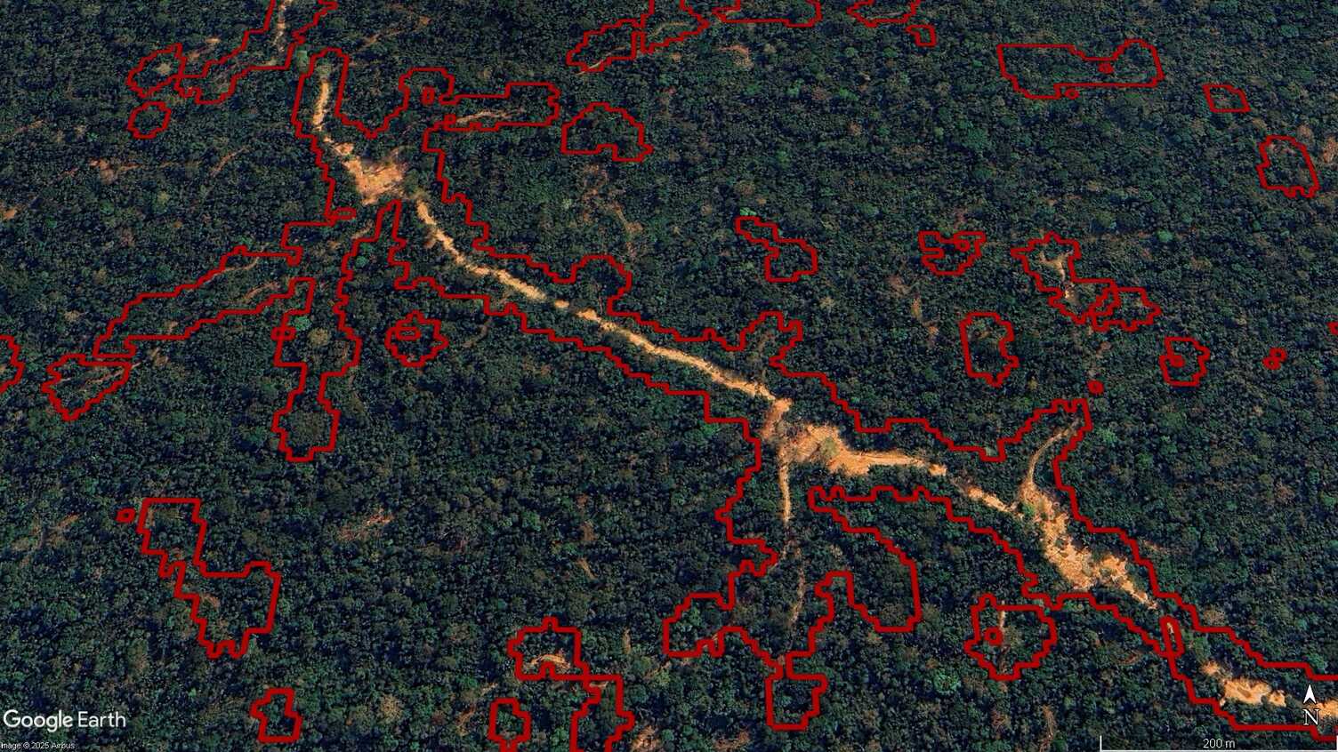
Peru manages roughly 68 million hectares of tropical rainforest where illegal logging is typically selective -- a handful of high-value trees removed per hectare -- making it very hard to detect with standard satellite change-detection tuned to larger-scale deforestation.
Detect individual illegally logged trees in near-real time from very-high-resolution satellite imagery, cross-checked against Peru's official forestry registers, to target field inspections.
Researchers at the University of Sheffield's Grantham Centre for Sustainable Futures built a machine-learning method analysing very-high-resolution satellite imagery for individual tree removal. Detected logging events are cross-referenced against SERFOR (Peru's forestry service) and SISFOR (its national forest-tracking system) to determine if activity falls inside an approved logging plan. OSINFOR, Peru's independent forest and wildlife oversight agency, adopted the tool to target field inspections, formally inaugurating it in 2025.
Across an initial 1.8 million hectares of monitored forest, the system identified 37% of all officially reported illegal logging. Peruvian authorities used the resulting evidence to seize more than 41,000 cubic metres of illegal timber between 2023 and 2024, worth over US$19 million, according to OSINFOR chief Williams Arellano.
The tool represents a step-change for enforcement timing, detecting selective logging while it is still happening rather than after full clearance is visible, and is designed to be extensible to other Amazon basin countries, though deployment to date has been limited to Peru.
National / regional programmes
Indicative funding routes for practices of this type — always check each programme's current calls and eligibility rules.
Do you run this practice? Claim it — verified implementers get a public contact pathway and can propose corrections.
Where this practice's information was retrieved from, and when.
Brazil
INPE's DETER system issues near-real-time satellite alerts on forest clearing across the Amazon and three other biomes, letting IBAMA dispatch …
Peru
Peru's Ministry of Environment has run Geobosques, a weekly satellite-based deforestation early-warning system, since April 2017; a PNAS randomized controlled …
Romania
Romania's Environment Ministry piloted Google Vertex AI on its SUMAL 2.0 timber-permit system, scanning 400,000 monthly permits and 1.6M photos …
Gabon
WWF and Wageningen University's Forest Foresight uses Sentinel-1 radar and ML to flag illegal-logging and mining risk months ahead. Gabonese …
Open full copilot Grounded in cited practices — always check the sources.