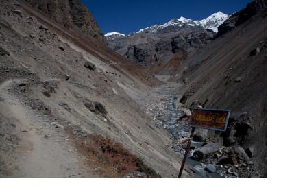
Nepal's National Disaster Risk Reduction and Management Authority (NDRRMA), working with the University of Melbourne, Tribhuvan University and the University of Florence, began piloting an AI-based landslide early-warning platform called SAFE-RISCCS (Spatiotemporal Analytics, Forecasting and Estimation of Risks from Climate Change Systems) in two high-risk sites: Kimtang village in Nuwakot district and Jyotinagar in Dhading district.
The system combines continuously updated satellite imagery from NASA, the European Space Agency and the Japan Aerospace Exploration Agency with local rainfall and ground-movement sensor data, feeding an AI model intended to flag landslide risk up to several weeks ahead. The project is funded jointly by the Government of Nepal and Australia's Department of Foreign Affairs and Trade, and developed under the leadership of University of Melbourne researcher Antoinette Tordesillas.
As of publication, the pilot had collected only about two months of ground data. Sanjaya Devkota, the project's technical adviser, said the system 'is still in a preliminary stage' and would need one to two years of data before it could forecast reliably; NDRRMA official Rajendra Sharma noted the pilot responds to landslides that 'climate change is fuelling ... further' in villages like Kimtang, where local resident Bina Tamang described the terrain as making landslides frequent. The AI component itself is not yet fully operational.
Read the full analysis: https://un-spider.org/news-and-events/news/university-melbourne-researchers-aid-nepal-villagers-advanced-landslide
Where this practice's information was retrieved from, and when.