Tallinn Digital Twin — EU-Backed 3D City Model for Planning and Citizen Engagement
Estonia
Tallinn built a public 3D city model and started monitoring 1,200km of streets to let planners and residents simulate development …
Singapore · Singapore · See the Singapore profile · See the Singapore profile
Evidence: Descriptive / self-reported Top 74% 57/100 · Ask Evidence Copilot about this practice
Singapore's national 3D digital twin, built with Dassault Systèmes from 2014–2022 using 50+ terabytes of geospatial data, lets planners simulate flood risk, AV routes and solar potential — though most cited benefits remain simulated, not independently measured.
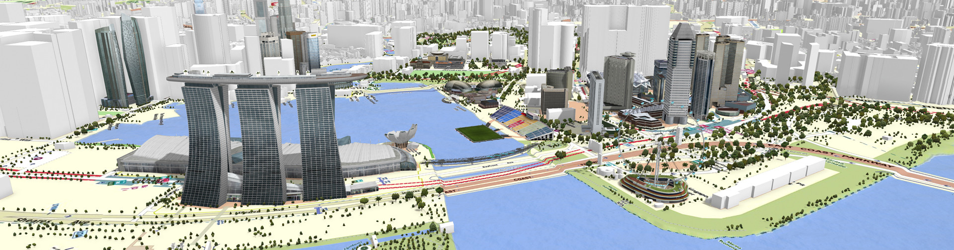
Announced as part of the Smart Nation initiative on 3 December 2014 and led jointly by the Singapore Land Authority, the National Research Foundation and the Government Technology Agency, Virtual Singapore is a high-resolution 3D digital model of the entire city-state, built on Dassault Systemes' 3DEXPERIENCity platform using laser-scanning aircraft and vehicles.
The platform integrates more than 50 terabytes of geospatial, infrastructure and environmental data, funded jointly by the national government and partner agencies including the Civil Aviation Authority of Singapore and the Public Utilities Board.
Documented use cases include flood-risk analysis, testing autonomous-vehicle routing without street deployment, assessing solar-panel and green-roof potential on building rooftops, and simulating emergency-response scenarios. The core platform was completed in 2022 after an eight-year build.
Independent reporting documents the platform's use cases and scale in detail but does not report independently measured before/after outcomes -- most cited benefits remain described as anticipated or simulated rather than empirically evaluated.
National / regional programmes
Indicative funding routes for practices of this type — always check each programme's current calls and eligibility rules.
Do you run this practice? Claim it — verified implementers get a public contact pathway and can propose corrections.
Where this practice's information was retrieved from, and when.
Estonia
Tallinn built a public 3D city model and started monitoring 1,200km of streets to let planners and residents simulate development …
United States of America
In July 2017, 15 volunteer teams in Richmond, Virginia logged 60,000+ car-mounted temperature readings, finding 15–20°F intra-city gaps that helped …
Peru
Since 2010, Lima Cómo Vamos has surveyed ~2,000 residents of Metropolitan Lima annually on urban quality of life. A 2022 …
Tanzania
Dar es Salaam's Ramani Huria trained 450 community members and students to map flood-prone informal settlements with OpenStreetMap and drones. …
Open full copilot Grounded in cited practices — always check the sources.