Great Bear Sea Project Finance for Permanence — Indigenous-Led Marine Conservation Trust
Canada
In June 2024, 17 First Nations closed a $335M Project Finance for Permanence deal with Canada, British Columbia and philanthropies, …
Palau · Koror · See the Palau profile · See the Koror profile
Evidence: Descriptive / self-reported Top 77% 33/100 · Ask Evidence Copilot about this practice
Palau's 2015 National Marine Sanctuary Act closed 80% of its ~604,000 km² waters to fishing. A 3-boat patrol fleet has since relied on satellite vessel-tracking, including a 2015 shark-poaching bust, formalised by a 2023 Global Fishing Watch data-sharing partnership.
Palau's National Marine Sanctuary Act (October 2015) closed 80% of its ~604,000 km² EEZ to commercial fishing, one of the largest fully protected marine areas created up to that point, but enforcement fell to a patrol fleet of just three vessels.
Palau paired physical patrols with satellite-based vessel tracking (AIS data) analysed by partners including Global Fishing Watch/SkyTruth; in September 2023 the Ministry of Agriculture, Fisheries and Environment signed an MOU with Global Fishing Watch to make vessel-tracking data public and add analytical support for licensing, port inspections and enforcement.
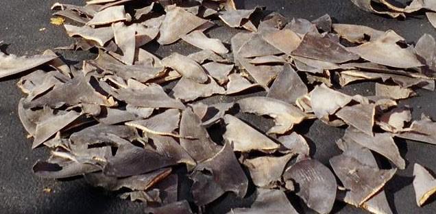
Satellite AIS tracking helped Palau's patrol boat Remeliik intercept the Taiwanese vessel Shin Jyi Chyuu 33 on 23 January 2015 after it was tracked going dark and reappearing in Palauan waters; the boarding recovered 304 shark carcasses and led to a US$100,000 fine.
Enforcement capacity remains limited relative to the area involved, so satellite tracking substitutes for constant physical presence rather than replacing it, and detection does not guarantee interception.
National / regional programmes Philanthropic / foundation funding
Indicative funding routes for practices of this type — always check each programme's current calls and eligibility rules.
Do you run this practice? Claim it — verified implementers get a public contact pathway and can propose corrections.
Where this practice's information was retrieved from, and when.
Canada
In June 2024, 17 First Nations closed a $335M Project Finance for Permanence deal with Canada, British Columbia and philanthropies, …
Japan
Yokohama's municipally managed eelgrass beds became the first site in Japan's J Blue Credit market, turning coastal seagrass restoration into …
Mayotte
France's marine natural park around Mayotte (est. 2010) protects a 1,300 km2 double-barrier-reef lagoon - 480 km2 of coral, 700 …
Seychelles
TNC's 2016 debt-for-nature swap ($21.6 M) and a 2018 World Bank blue bond ($15 M) funded SeyCCAT, expanding Seychelles marine …
Open full copilot Grounded in cited practices — always check the sources.